
![]()
Welcome to The Moatfield.
The Moatfield is an historic site that dates back to medieval times. It was once the site of a medieval manor house called Bournehall which was completely surrounded by a large moat. Although the house is no longer there, the name is remembered in the name of local streets such as Bournehall Lane, Bourne Road, Moatfield Road and the adjacent Bournehall School.
The site has been identified as an Area of Archaeological Significance because of its size and good preservation. Various archaeological surveys have been carried out on the site.
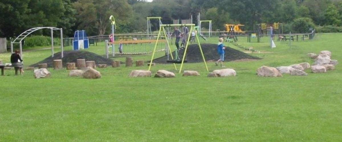
The play area was extended in 2011 and includes a zip wire, small kick about area with goal units, mounds connected by a bridge, nest swing, climbing unit, spinning dish, Duel swing and an obstacle course (monkey bars, stepping logs, climbing net and boulders).
There is also a series of resistance outdoor fitness equipment including a kickboxing pillar.
Car park is accessed off Bournehall Lane, WD23 3JU. Directions here
Public Transport Information:Buses W7 and W9 run between Watford, Bushey and Borehamwood. The nearest W7 bus stop to the Moatfield is in the High Street and the nearest W9 bus stop is in Bournehall Avenue.
Train – Bushey main line station (on the Silverlink Train service which operates in and out of London Euston) is approx 1 kilometre from the Moatfield. Both the W7 and W9 buses stop at the station.
Further information on public transport is available here: www.intalink.org.uk and www.nationalrail.co.uk
Cycling:
A greenway is being installed through the park, linking the local schools and to Aldenham Road
![]()
Welcome to The Moatfield.
Share your experience
Tell your friends on social media about what you did at The Moatfield: